-


Follow Us

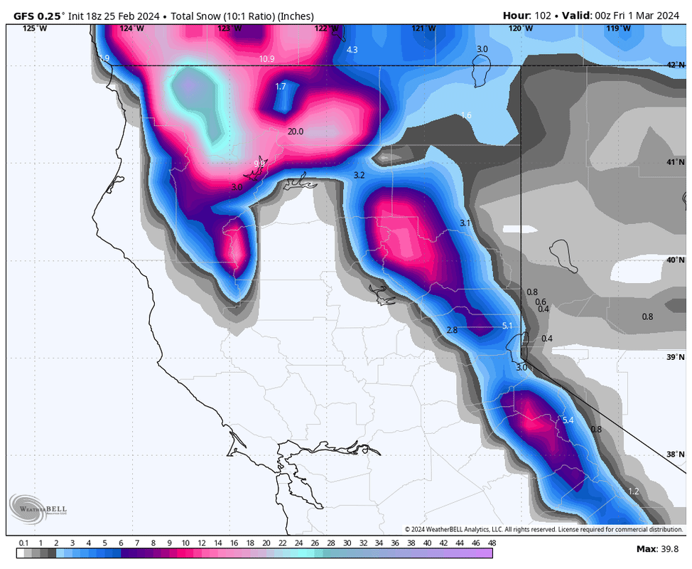
With several feet falling in the Pacific Northwest over the next several days, the Sierra will likely grab the deepest storm of the season for the upcoming weekend. Models 5 days out can certainly change and we will monitor for any deviation in the storm track. The weather models are very bullish at this point for a big dump!
Powderchasers have high confidence in a significant storm with moderate confidence in totals exceeding 3 feet with some models showing 5-6 feet.
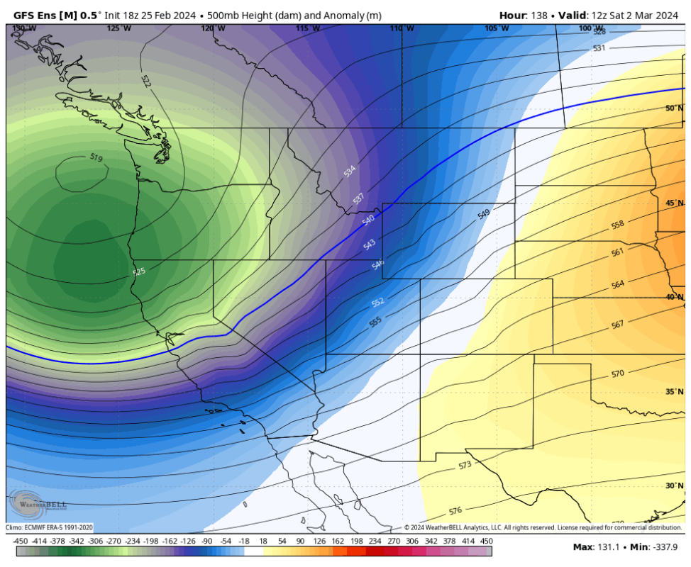
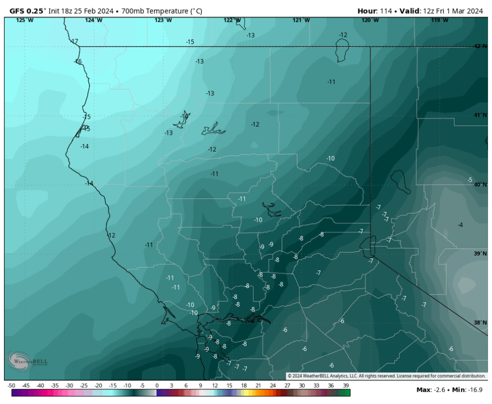
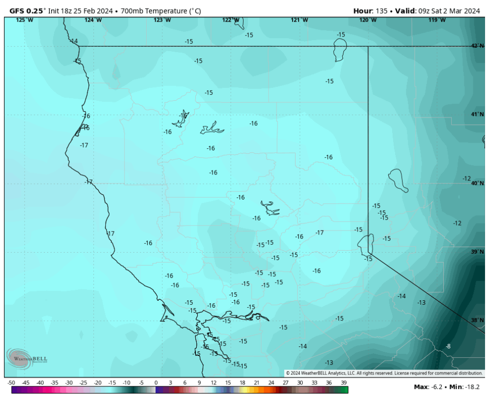
Temperatures are respectable with snow levels likely starting near lake level (5500) on Thursday night. The heaviest period of snowfall appears to be late Thursday to early Saturday. Snow levels will plummet from Friday night to Saturday with arctic air and much colder temperatures. Temps at 10K feet will be in the single digits with lake level in the teens by Saturday
The majority of snow will fall before the coldest air, however with lake-level snow levels we anticipate some healthy totals at all elevations through Saturday with very low-density powder continuing at lighter intensity into Sunday. (Medium density to low density)
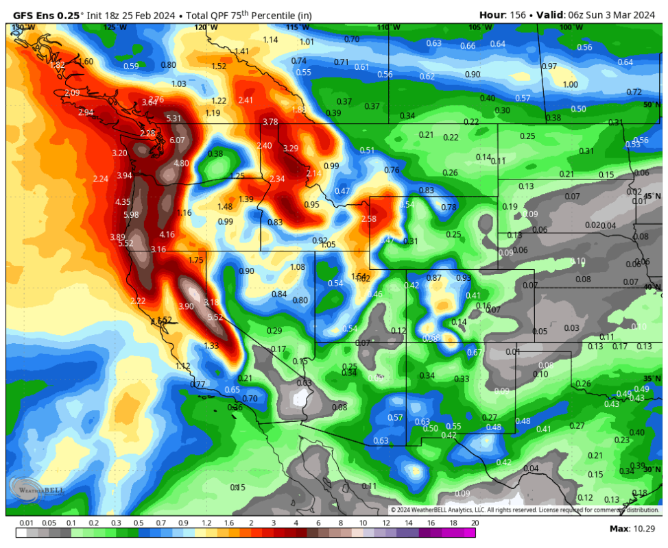
Bottom Line: Decent odds of a significant storm for the Sierra late this week. Medium-density snow at 8K initially migrates to lighter-density blower by the weekend.
You can follow @powderchasers on Instagram and FB, or our forecasts on the web at powderchasers.com. Send us your pics to use in future posts on Powder. Let's hope these models hold up!
More must-reads:
- Cale Makar sparks Avalanche to go up 3-1 in series vs. Jets
- Women's hoops icon Candace Parker retires: Basketball world pays tribute
- The '100 catches in an NFL season' quiz
Breaking News
Customize Your Newsletter
 +
+
Get the latest news and rumors, customized to your favorite sports and teams. Emailed daily. Always free!