-


Follow Us


The climate phenomenon closely watched by powder hounds everywhere, La Niña, is still here, but it should last for only a month or two more before disappearing early next year.
That’s according to the Climate Prediction Center, which, earlier this month, released an update on the status of the El Niño–Southern Oscillation (ENSO)—the three-part pattern that includes La Niña.
According to the Climate Prediction Center, La Niña is expected to continue through the December to February period, with neutral conditions favored starting between January and March 2026.
When ENSO enters a neutral phase, forecasters don’t necessarily expect average or near-average weather conditions. Instead, without La Niña or its counterpart, El Niño, influencing the weather, it becomes harder to accurately anticipate temperature and precipitation patterns far in advance.
Keep reading for more about La Niña.
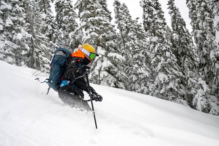
The 2026 POWDER Photo Annual is here! Look for a print copy on a newsstand near you, or click here to have a copy shipped directly to your front door.
Why Do Skiers Care About La Niña?
The two ends of the ENSO spectrum—La Niña and El Niño—are useful tools for forecasters working to anticipate what a given winter might look like in advance. Each phase corresponds with water temperatures in the tropical Pacific Ocean: La Niña is cool; El Niño is warm.
Those shifts in temperature disrupt atmospheric circulation and are associated with historical weather patterns.
For La Niña, that typically translates to colder weather and more snow across the northern half of the U.S., particularly in Pacific Northwest states including Washington, Oregon, and Idaho (the southwest, meanwhile, gets less snow historically). That impact exists—but is less consistent—when La Niña is weak, as it is this year.
In short, skiers watch La Niña or El Niño because it can clue them in to which ski resorts might tally the highest powder totals. After all, it’s fun talking about winter before the snow starts flying.
But as this ski season has shown, La Niña loads the dice, but doesn’t create sure bets. While the Pacific Northwest has certainly been wet, it hasn’t been very cold so far—Washington’s mountains have been doused with rain this month, delaying ski resort openings and causing catastrophic flooding.
Still, it’s only December. Chillier weather and accompanying snow are expected in Washington this week, perhaps hewing closer to a traditional La Niña pattern.
Meanwhile, much of the West faces a snow drought, with warm weather producing plenty of rain, but not powder. The incoming storm system could tilt the snowpack towards more normal territory, though, given how early it is in the season.
More must-reads:
- Giannis Antetokounmpo has clear message amid NBA trade rumors
- WNBA moves closer to labor strike following Players Association vote
- The 'NFL's active TD-catch leaders' quiz
Breaking News
Trending News


Customize Your Newsletter
 +
+
Get the latest news and rumors, customized to your favorite sports and teams. Emailed daily. Always free!

PRIVACY POLICY EDITORIAL POLICY CONTACT US
ABOUT YARDBARKER TERMS OF SERVICE
Use of this website (including any and all parts and
components) constitutes your acceptance of these
Terms of Service and Privacy Policy.
This site is for entertainment purposes only.
There is no gambling offered on this site.
Gambling Problem? Call 1-800-Gambler.