-


Follow Us

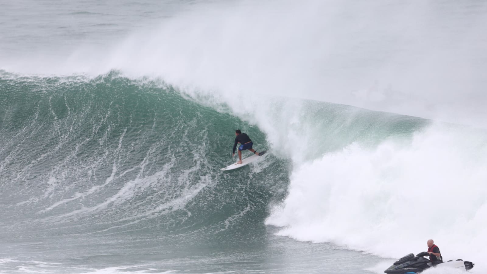
If you’ve glanced at your social feed over the last two days, you’ve likely been as glued as we have to the series of mind-bending barrels hurling into a corner of Australia courtesy of Tropical Cycline Alfred. Name a surfer, not even a pro, who resides in Northern New South Wales and Southern Queensland, and the odds are good they’ve found well-overhead tubes in the past few days. Kirra, in particular, has been on fire. When Mick Fanning starts pumping, you know it’s good.
But what exactly is fueling this East Coast swell bender? As a surfer raised predominantly in California, tropical cyclones hovering off the coast are about as alien to me as actual aliens. So I hit up expert surf forecaster Craig Brokensha of Swellnet to learn more about what’s going on at the Gold Coast.
“Tropical Cyclone Alfred formed two weekends ago, high in the Coral Sea, off the north Queensland Coast,” Chris explained. “It then meandered slowly east and then south over the following week while slowly strengthening to a Severe Tropical Cyclone (category 4). The lack of any upper atmospheric wind to steer Alfred away from the Australian coast has allowed Alfred to move closer towards the premier surf breaks in south-east Queensland, lighting up Noosa Heads and surrounding breaks for days on end. Alfred has since sat due east of the Gold Coast, aiming persistent severe gales towards the mainland as southerly winds (wrapping around cyclones south-western flank) groomed the large 3x overhead surf into ruler edged lines at Kirra.”
Chris noted that because the system is near the coast, the swell is much more consistent than usual. Sitting 267 miles east of the Gold Coast as of Wednesday morning, the cyclone’s energy is sending nonstop sets, brutal currents and massive, hollow waves. But it won’t last forever. As Alfred heads toward the mainland, it’s poised to become the first to cross into the southeast Queensland region since 1974 and things could get downright dangerous.
“Over the coming 24-48 hours, Alfred is due to re-intensify while pushing back into the mainland, crossing the Gold Coast and Brisbane regions bringing extra-large, stormy conditions that won’t be favourable for surfing, along with flooding rains, destructive winds and widespread erosion,” Chris said. State governments in Queensland and NSW have already declared a state of emergency. The Australian Bureau of Meteorology has predicted the storm to make landfall between Queensland's Sunshine Coast and Gold Coast by 2 a.m. Friday. Wind gusts up to 96 miles per hour and heavy rainfall are expected on Wednesday and will continue to Friday as the category two storm arrives.
"The key message is that we can expect from this system along with destructive wind and extensive flooding most likely major flooding as well as the potential for some dangerous and life-threatening flash flooding," the BOM said in a statement. It could be a rough stretch for many residents on the coast. NSW Emergency Services Minister Jihad Dib said Northern Rivers residents should think about evacuating before the cyclone arrives.
Best of luck to all those Australians preparing for the worst. Batten down the hatches and get some waves when this thing is all over.
More must-reads:
- Diego Luna's rise proves annual 'Camp Cupcake' still has plenty to offer USMNT
- Emma Navarro win continues unprecedented run of parity in Wimbledon singles' ladies draw
- The 'MLB ballpark names' quiz
Breaking News
Trending News


Customize Your Newsletter
 +
+
Get the latest news and rumors, customized to your favorite sports and teams. Emailed daily. Always free!

PRIVACY POLICY EDITORIAL POLICY CONTACT US
ABOUT YARDBARKER TERMS OF SERVICE
Use of this website (including any and all parts and
components) constitutes your acceptance of these
Terms of Service and Privacy Policy.
This site is for entertainment purposes only.
There is no gambling offered on this site.
Gambling Problem? Call 1-800-Gambler.