-


Follow Us

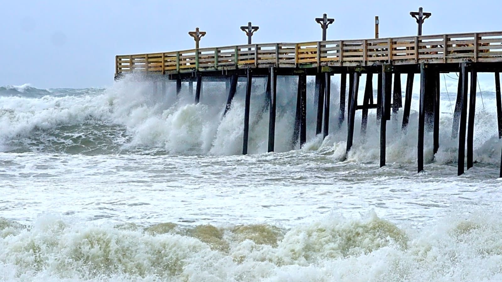
Experts, swell-chasers, and wary coastal property owners continue to monitor the trajectory, and strength of Hurricane Erin, as it continues up the east coast.
And one of the latest developments, Hurricane Erin has been upgraded to a Category 5 – the highest level on the Saffir-Simpson Hurricane Wind Scale.
The storm is currently looming over the Caribbean, with a trajectory moving northward, with a path that curves away from the eastern seaboard, away from landfall, yet still sending stormy conditions (and potentially sizable swell) to the east coast.
As Erin moves over warmer waters, intensifying the storm, it has been upgraded to Category 5. AccuWeather Lead Hurricane Expert Alex DaSilva, called the conditions “near perfect,” when it comes to the storm strengthening on its path.
"Erin is forecast to slowly curve to the north as it continues to strengthen over the weekend. At this time, the storm is forecast to remain hundreds of miles off the East Coast," DaSilva said. When it comes to the waves, he continued:
"Beaches along the entire East Coast, from Florida to New England and Atlantic Canada, will likely experience rough surf and dangerous rip currents as Erin tracks north and eventually northeast.”
No specific numbers on what the waves will actual look like – like the previous and absurd 100-foot estimate for the East Coast – as Hurricanes present a tricky and ever-changing forecast dilemma, but whatever develops, surfers are ready to rock.
As mentioned, Erin has reached Category 5 status, the highest classification. According to NOAA that means: “Winds 157 mph or higher (137 kt or higher or 252 km/hr or higher). Catastrophic damage will occur: A high percentage of framed homes will be destroyed, with total roof failure and wall collapse. Fallen trees and power poles will isolate residential areas. Power outages will last for weeks to possibly months. Most of the area will be uninhabitable for weeks or months. The Keys Hurricane of 1935 and Andrew of 1992 made landfall in South Florida as Category Five hurricanes.”
The latest from Surfline, regarding the surf coming out of Erin, reads:
“We have high confidence that Erin will take a recurving track, sending widespread swell throughout the Caribbean and along the East Coast. Looking longer term, Erin is forecast to track into the North Atlantic, becoming a powerful extratropical cyclone and sending a very solid shot of long-period swell toward the U.K. and parts of Europe. We’ll be keeping a close eye on that as well.”
Stay tuned, and stay safe.
More must-reads:
- Fever receive devastating injury news on Sophie Cunningham
- Blue Jackets sign former first-round pick to professional tryout
- The '2024 NFL rushing TD leaders' quiz
Breaking News
Trending News


Customize Your Newsletter
 +
+
Get the latest news and rumors, customized to your favorite sports and teams. Emailed daily. Always free!

PRIVACY POLICY EDITORIAL POLICY CONTACT US
ABOUT YARDBARKER TERMS OF SERVICE
Use of this website (including any and all parts and
components) constitutes your acceptance of these
Terms of Service and Privacy Policy.
This site is for entertainment purposes only.
There is no gambling offered on this site.
Gambling Problem? Call 1-800-Gambler.